Google has withdrawn a new artificial intelligence image-generation tool from Google Earth just hours after its global launch, following concerns that it could be used to create misleading images of real locations and fictional events.
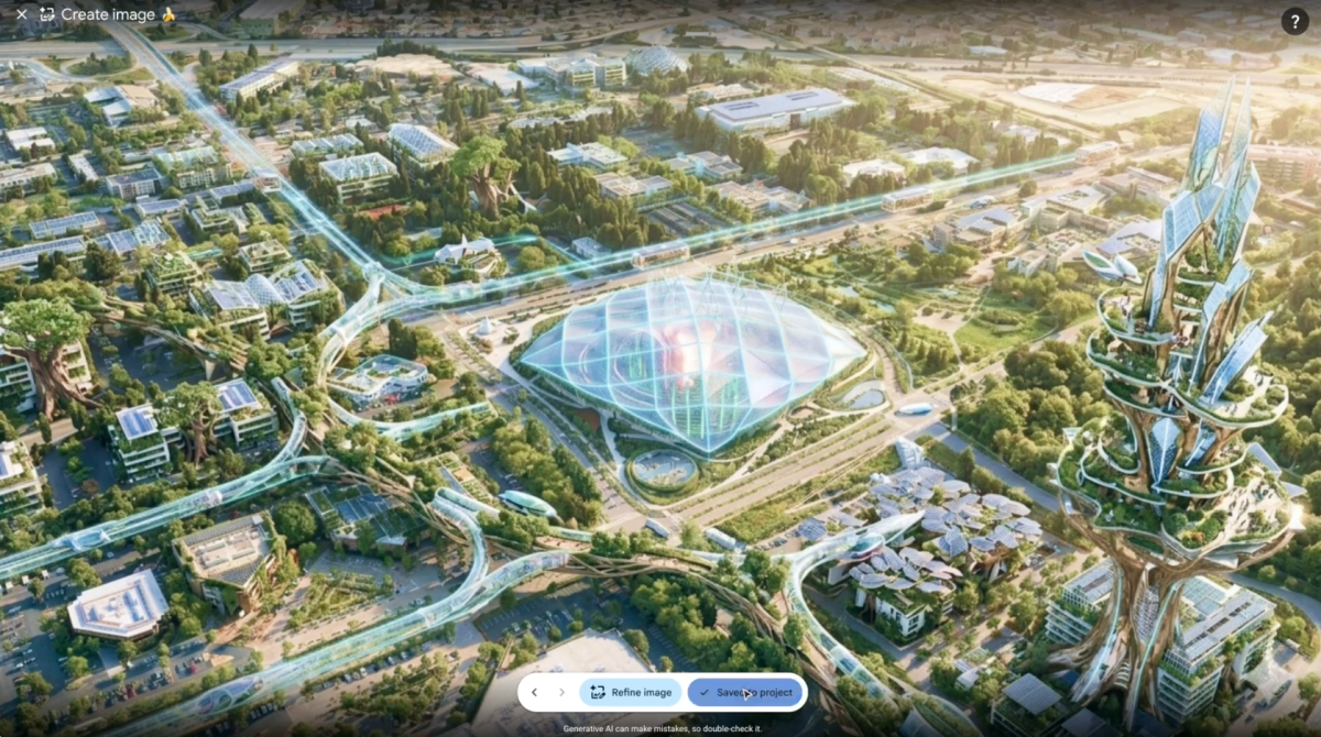
The feature allowed users to combine Google Earth’s satellite, aerial and 3D imagery with Google’s Nano Banana AI model to generate customised scenes through simple text prompts.
Google Removes the AI Feature from Google Earth
Google announced on July 31 that it was rolling back the feature while it worked on introducing stronger safeguards.
The company said it had seen geospatial professionals use the tool for several valuable purposes. However, it had also identified screenshots of generated images that appeared to violate its policies.
The decision came only one day after Google officially introduced the feature and promoted its potential applications in education, urban planning, real estate and visual storytelling.
How Did Google Earth’s AI Image Tool Work?
The feature was introduced on July 30 as a new way to create customised images using the geographical data available through Google Earth.
Users could open Google Earth on the web, navigate to a specific location, select the “Create Image” option and enter a written description of the scene they wanted to generate.
The Nano Banana model would then use the location’s satellite, aerial and 3D imagery as the basis for producing a new AI-generated image.
This made it possible to transform real locations into fictional or speculative scenes without needing professional image-editing experience.
Google Promoted Educational and Commercial Uses
Google initially presented the feature as a creative tool that could help users visualise locations in new ways.
Teachers, for example, could use it to show students what historical cities or landmarks might have looked like in the past.
Real estate professionals could also generate visual concepts showing how undeveloped land might appear after the construction of residential or commercial projects.
Other potential applications included architectural presentations, tourism campaigns, environmental visualisations and creative geographical storytelling.
However, the feature’s ability to generate realistic images based on real locations quickly raised concerns about its possible misuse.
Users Create Fake Images of Real-World Events
Shortly after the feature became available, researchers and journalists began testing whether it could generate fabricated images involving politically sensitive locations, wars, natural disasters and major landmarks.
Open-source researcher Henk van Ess said he tested prompts involving refugees at the Mexican border, a nuclear facility in Iran, a plane crash in Amsterdam and a damaged hospital in Gaza.
According to van Ess, the tool did not reject any of these requests.
NPR subsequently published examples of images created with the feature, including a fabricated scene showing fires in Iran and another depicting Washington, D.C., submerged by floodwater.
The BBC also reported generating images that appeared to show the Eiffel Tower collapsed and the Great Pyramid of Giza disappearing into a massive sinkhole.
Although the scenes were fictional, their connection to real geographical locations made them potentially convincing when viewed without context.
Experts Warn About Disinformation Risks
The launch prompted immediate concern among journalists and open-source intelligence researchers who rely on satellite and aerial imagery to verify events.
Visual evidence from mapping platforms is regularly used to investigate wars, natural disasters, human rights violations, military activity and major news events.
Allowing users to generate realistic but fictional scenes from the same geographical imagery could make verification more difficult and increase the volume of misleading content circulating online.
Evan Hill, a Washington Post reporter specialising in visual forensics, warned that the opportunities for abuse and disinformation were effectively limitless.
The greatest concern was not necessarily that the generated images would appear directly inside Google Earth, but that users could take screenshots and share them on social media without explaining that they were created by AI.
Google Says Generated Images Were Clearly Labelled
In its July 31 statement, Google clarified that the AI-generated images did not appear in the main Google Earth experience for other users.
The images were created privately and were not added to Google Earth’s official satellite or aerial imagery database.
Google also said the generated content included watermarks identifying it as AI-generated.
However, critics argued that watermarks may not provide sufficient protection because screenshots can be cropped, edited, compressed or shared without their original context.
A fabricated image may therefore continue circulating after the visible label has been removed or obscured.
Why Fake Satellite Images Are Particularly Sensitive
AI-generated images have already created challenges for news organisations and social media platforms, but fabricated satellite imagery introduces additional risks.
Images associated with mapping platforms are often perceived as objective records of physical locations. This can make manipulated geographical imagery appear more credible than an ordinary AI-generated picture.
False images could be used to suggest that military strikes, floods, fires, protests or infrastructure damage occurred when no such event took place.
They could also interfere with the work of journalists, investigators and researchers who use visual evidence to confirm or challenge claims about events in specific locations.
Google Promises Stronger Safeguards
Google did not announce when the image-generation feature might return to Google Earth.
The company said it was rolling back the tool while it worked on stronger guardrails, but it did not provide details about the restrictions it plans to introduce.
Possible safeguards could include tighter limitations on prompts involving conflicts, disasters, sensitive facilities and public safety incidents.
Google may also need to introduce more durable methods for identifying generated images after they are downloaded or shared outside the platform.
The incident demonstrates that visible watermarks and platform-level labels may not be enough when AI-generated content can easily be copied and distributed elsewhere.
The Challenge of Integrating AI into Mapping Platforms
Google Earth was first launched in 2005 and has become one of the world’s most widely recognised digital mapping services.
The platform allows users to explore the globe using satellite imagery, aerial photography, 3D terrain and Street View. Images are periodically updated, although the frequency varies depending on the location.
Integrating generative AI into such a platform creates a significant challenge because Google Earth is primarily associated with representations of the real world.
Generating fictional images inside a creative design application is different from creating them within a trusted mapping environment. The surrounding context may lead users to assume the content represents a genuine place or event.
The rapid withdrawal of the feature highlights the need for technology companies to assess not only what generative AI tools can create, but also how their output may be interpreted, modified and distributed.
As AI becomes more deeply integrated into mapping and geospatial services, companies will need to balance creative applications with the need to protect the credibility of real-world visual information.
Read the article in